Tuesday, 24 May 2011

So Mr Whitmore we meet?

One year ago today, there I was on a rest day in Fort William, you may remember the blog, its the one about Star Trek. Boy was I off with the fairies that day!! Anyway, yep a year ago I was in Fort William, which is exactly where I am in my walk down the country on the treadmill. So hence the title of meeting myself, albeit a year later.
Last year I remember this being a particular good period in the walk, having just completed the West Highland Way, with the company of Blair and just before heading off up the Great Glen. Yes, Ms Bradbury's programme a few weeks ago on the Caledonian Canal brought back memories of a great days walk, how I felt in the home straight (only had about 180 miles left!!)Back to the present. I'm going to undertake a challenge on the treadmill walk which I missed last year, that's a diversion up Ben Nevis, simulated on the treadmill. Unfortunately the mill on goes upto 10 degrees, so short of propping on end up against the wall or sticking books under one end then I think its going to be the fastest ascent/descent in history. (No screaming knees coming down the steps this time). Given the 2D distance is on a couple of km, then all should be complete in about 40 minutes. I can then set of out of Fort William southbound.
Just had a thought, when I walk through Larkhall, on the simulated walk, I'm going "flick the "V's"" all the way, you can tell I'm still not impressed with that place.
Recent walking adventures have included strides over two of the local hill ranges and the completion of the Severn Way.
Having previously discussed the hike/camp option and purchase of a single man tent, the time was right to put it to the test, or me to the test. So, parking up in Mid Wales, I spent 2 night under canvas, whilst taking the opportunity to complete the first 30 odd miles of the River Severn. From its source up on the side of "Plynlimon" down to Newtown, thus completing all of the LDP. The walk upto and from the source was cracking, a great day weatherwise and also great to see the longest river develop from a muddy puddle to a flowing wide river. To think of the outlet into the Bristol Channel and the 2 massive bridges, compare to the trickle and the small wooden bridge, all in 210 miles.
The walk had me ascending some 2000m over the two days (mostly undulating the second day). This and the recent walks up the hills is the start of my warm up to the next LDP (or paths). In less than 10 weeks I'm off to start the C2C (coast to coast), but this time I do not intend to complete it, just reach Kirkby Stephens, (just short of 1/2 way). Having covered the best bit (my view) I will swing south and head toward Manchester, leaving two companions to continue eastwards. (just hope they realise and don't follow me - there a bit daft that way!)
The southerly route will follow a little known LDP called the Thirlmere Way. This path goes from the dam on Thirlmere Lake (Lakes) following the route of the tunnel which delivers water to Manchester. I have complete bits at either end but now wish to join these up by walking to Abbey Village. Completion will mean another part competed path being finished, this years objective. Prior to starting this I will also used further legs of the Birmingham to Aberwysth Walk to regain my mountain legs, likewise I have some scheduled meetings with Lakeland mountains, both next week during my family week holiday in Ambleside. And also the end of June where I will meet up with an old friend, I met walking once (he was walking JOGLE). He is currently climbing all the Wainwright's in this his 60th year for charity, so I look forward to the walking and meeting up again.

Sunday, 1 May 2011

And what of Mr B?

In my recent summing up of the final days of the St Cuthberts Way, I failed to mention whether Mr B made it all the way to Holy Island. for those who have read the daily enters of this walk, you will know we were constantly accompanied by Mr B. Wherever we went a bee, (Mr B) would be buzzing around.
Well, sad news, I can say we never came across him whilst on Holy Island, there was a lack of any airborne insects there, maybe consumed by the bountiful numbers of birds or maybe to scared to cross the causeway, in case of the tide coming in and not being able to land and rest. After all they can not read the tide timetable.
As we all know insects can't read.
My theory on his disappearance is somewhat different.
If you don't like sad stories, leave now - you've been warned........
Anyway for those who are left. My theory is down to the path of the St Cuthberts Way. I'm sure I heard him happily buzzing shortly before arriving at the causeway, about the same time we crossed the main East Coast Train Line, and the arrival of that fast inter city train.... get where I'm coming from? Well I reckon he arrived in Edinburgh on the from of the Inter City train, some 65 miles away before we reached Holy Island. Following the Northumberland Coast up to Berwick, which surprising brings me onto the subject of the Northumberland Coast Path.
Not knowing of these walk before, we stumbled on a book (as well as the St Oswald Way) whilst on Holy Island. As we fell in love (arhhh) with this area during the SCW (why didn't I use that 3 letter acronym earilier, I ask myself) our next LDP together will be the NCP (started use of that acoryn nice and early - lessons learnt and all that). That following my solo Pennine Way (no friends me, or non who are up for longer LDP's). So subject to the Mayan calendar not being correct and the world ending 21/12/2012, we'll be doing it in 2013...

Tuesday, 26 April 2011

days 5 & 6 wooler to fenwick to Holy Island

Just to catch up on the fin. 2 dats of the St Cuthberts Way for those
worried we hadn't actually made it to the end. Well we did, and what
an end it was, onto that later.
Firstly day 5, following our great curry in Wooler (that had to be the
meal of the trip) we had an undulating days walk over the hills of
Northumberland, we thought we'd finished the hills with the Cheviot,
but no. Towards the end of the day, everything happened together, with
a detour to St Cuthberts cave and almost immediately after our first
detailed sighting of the coast, we'd seen it on the horizon the day
before but we could make out the end of the walk on Holy Island.
So onto the final days walk over the causeway onto Holy Island and the
end. I was for following the Pilgrims Trail across the sands, marked
by wooden posts and a refuse elevated platform, by Jo was for
following some Germans walking along the road (we'd sat behind them at
the previous nights meal -that's how we know)
Along with all the us making a crossing whilst the tide was low was
aload of tourists. When we arrived the place was heaving with people,
so after the photo at the end we chose a quite bay to sit in, here we
stayed until the tide came in. When we returned to the village it was
empty and all shut, what a difference to before.
The journey home was uneventful apart from a shopping trip to Gretna
Village, remember passing there on my LEJOG.

Monday, 18 April 2011

day 4 hethpool to wooler

The "S's", sun, scenery, song and snakes.
The walk over to Woller had them all, firstly sun, it was a glorious
blue sky day all day.
Next, scenery, lots of that to, walking through the Northumberland
National Park, upp at 300m+ for most of the day, with outstanding
views over th Cheviot Hills, and of course the view over to the
Cheviot itself, standing at 800m+. (do that next year on the Pennine
Way)
Next song, bird song all day. Like all the walk we have been
surrounded by nature, never for from a bird, bee or a snake.
Yes lastly a snake, I've been on the lookout for snakes most the time
I've been walking and the in the middle of the path, right up on the
moors, an adder.
Unfortunately no pictures, low battery on the phone, so will have to
wait for the main camera to be downloaded.
Finally had a bostin curry last nite, best for a long time, highly
recommend the Spice Village Curry House in Wooler, if anyones up this
way

Sunday, 17 April 2011

day 3morebattle to hethpool

Today's was a longer walk then yesterdays and had us walking up/down,
up/down. In-between we found ourselves in the delightful town of Kirk
Yetholm, those walkers reading the blog will immediately know the
name, realising it is infact the northern end of the Pennine Way. Next
years walk and blog....
Entering the town occurred exactly one year to the second, to me
starting my LEJOG. This time last year I was writing the first blog of
that adventure.
As the evenings accommodation did not have a local pub we decided to
eat in KY, a filling baguette was consumed at the pub which marks the
end of the Pennine Way. Leaving the pub we then shared the Pennine Way
for a few miles, mainly uphill. For the second time in the day (first
straight after breakfast)an ascent was made on a full stomach. After
leaving the Pennine Way, a variety of things quickly occurred, firstly
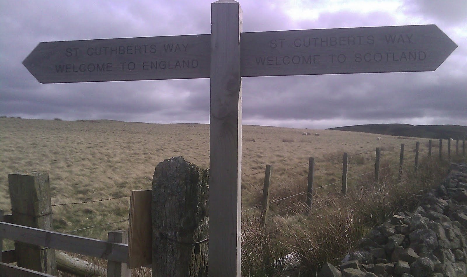
we crossed the border, entry we difficult as we did not have our
passports. Secondly, the path changed. The grass changed colour, the
ground boggy'r and the features which assisted the walker all the way
thro the Scottish part, i.e.steps, bridges etc. ceased. Every man for
himself thro the bog and stream crossings. Waymarking which has been
excellent until the border, now seems to be gradually worsening.
Mr B's been back, not as often as yesterday, doesn't like the hills,
prefers the road walk, I mean flying.
On top of the first hill we met a welcome plaque, declaring both the
highest point and half way, this after two and a half days of six
days, second half looks to be easier (hope I haven't spoken too soon)